Last updated: June 9th, 2022 at 20:43 UTC+02:00
SamMobile has affiliate and sponsored partnerships, we may earn a commission.
Reading time: 2 minutes

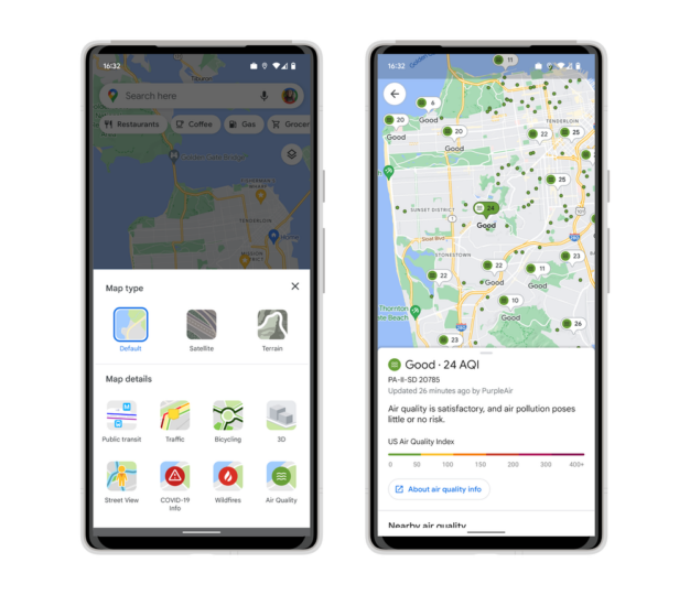
Notably, you will get detailed information about the air quality, whether it is smoggy, smoky, bad, or wonderful to head outdoors. Moreover, it will also show Air Quality Index numbers (from 0 to 400+) along with information for outdoor activities, when was the information updated, and links to learn more.
A green air quality icon sits in the bottom-right corner besides Public transit, COVID-19 info, and wildfires. The data comes from trusted government agencies, which include the Environmental Protection Agency (EPA) and PurpleAir in the US. FYI, PurpleAir is a low-cost sensor network that gives a hyperlocal view of conditions.
You can add the air quality layer to your map by simply tapping on the button located in the top right corner. Then, select Air Quality under Map Details. In the following months, Google Maps will also show smoke data across the US, obtained from the National Oceanic and Atmospheric Administration on Google Search.
If you prefer hyperlocal weather and air quality information, check out some of these best weather apps. They provide detailed forecasts and a lot of useful information about the quality of air in your area.
Join SamMobile's Telegram group and subscribe to our YouTube channel to get instant news updates and in-depth reviews of Samsung devices. You can also subscribe to get updates from us on Google News and follow us on Twitter.